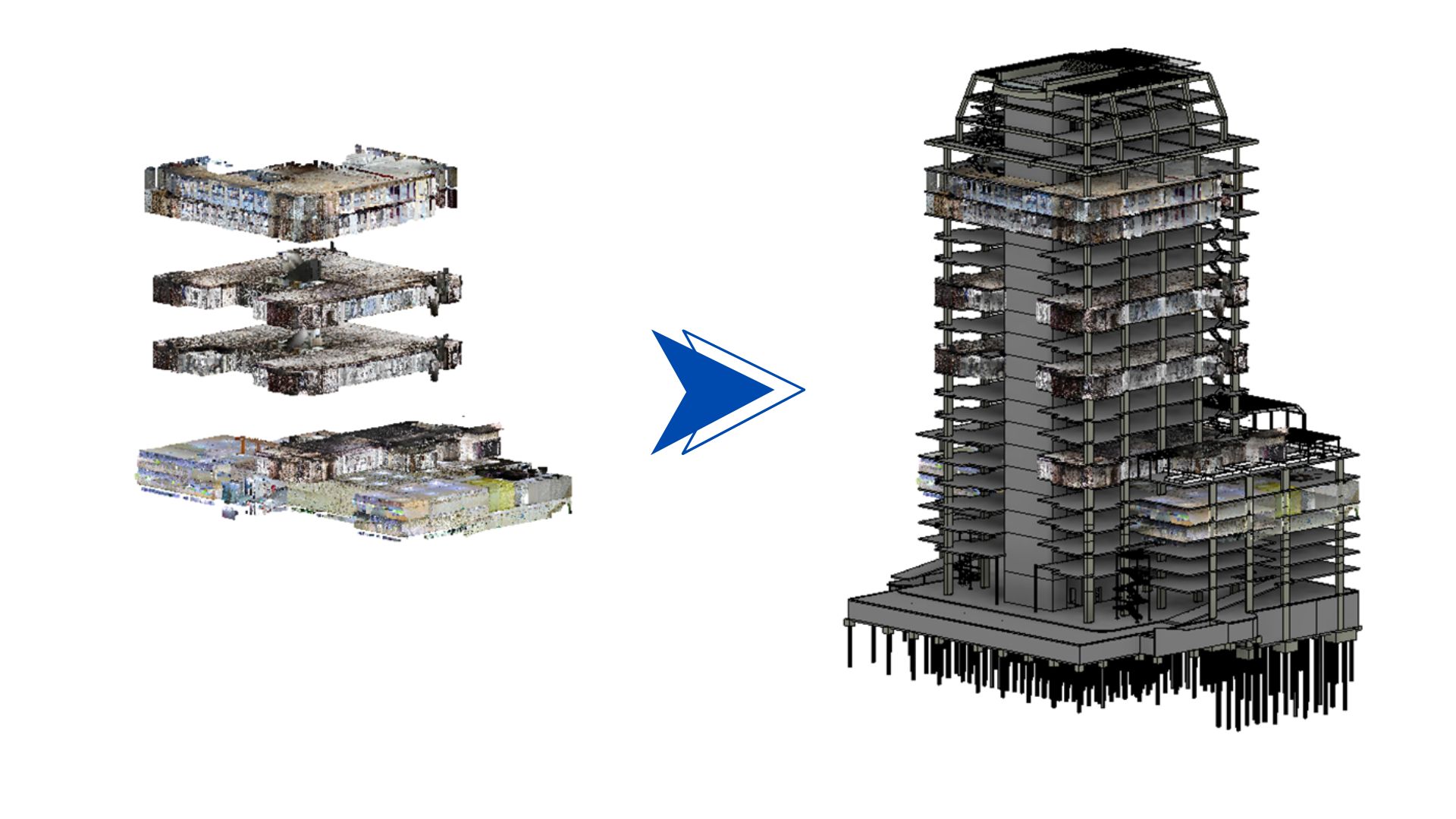
- Processed and analyzed point cloud data for the Sathorn 21 project.
- Converted raw scan data into usable 3D models for existing conditions.
- Used point clouds for accurate measurements, clash detection, and as-built documentation.
- Aimed to provide precise spatial information for renovation and design work.
Point Cloud
What?
How?
- Utilized Navisworks and Solibri for clash detection and model review.
- Developed Python scripts with Revit API for automated data extraction and validation.
- Integrated Power BI for interactive quality control dashboards.
- Established clear communication protocols for issue tracking and resolution.
Method
flowchart TB
A[" Laser Scan"]
B[" Raw Point Cloud"]
C[" Data Processing & Cleaning"]
D[" BIM Model Creation"]
E[" As-Built Documentation"]
A e1@--> B
B e2@--> C
C e3@--> D
D e4@--> E
e1@{animation: fast }
e2@{animation: fast }
e3@{animation: fast }
e4@{animation: fast }